


Brazos Valley COG--Brazos County--College Station & Bryan Cities PUMA, Texas
About
Outline

Summary
| Unique Area Identifier | 194198 |
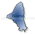
| Name | Brazos Valley COG--Brazos County--College Station & Bryan Cities PUMA |
| State | Texas |
| Area (square miles) | 591.24 |
| Land Area (square miles) | 585.45 |
| Water Area (square miles) | 5.79 |
| % of Land Area | 99.02 |
| % of Water Area | 0.98 |
| Latitude of the Internal Point | 30.65672540 |
| Longtitude of the Internal Point | -96.30238870 |
Maps


Graphs
Select a template below for downloading or customizing gragh for Brazos Valley COG--Brazos County--College Station & Bryan Cities PUMA, Texas


Neighbors
Neighoring Public Use Microdata Area (by Name) Neighboring Public Use Microdata Area on the Map
Top 10 Neighboring County (by Population) Neighboring County on the Map
- Brazos County, TX (194,851)
- Washington County, TX (33,718)
- Grimes County, TX (26,604)
- Burleson County, TX (17,187)
- Leon County, TX (16,801)
- Robertson County, TX (16,622)
- Madison County, TX (13,664)
Top 10 Neighboring County Subdivision (by Population) Neighboring County Subdivision on the Map
- Bryan-College Station CCD, Brazos County, TX (119,509)
- South Brazos CCD, Brazos County, TX (46,507)
- Navasota CCD, Grimes County, TX (17,995)
- Northeast Brazos CCD, Brazos County, TX (15,438)
- West Brazos CCD, Brazos County, TX (13,397)
- Anderson-Bedias CCD, Grimes County, TX (8,609)
- Hearne CCD, Robertson County, TX (7,327)
- Franklin CCD, Robertson County, TX (5,790)
- Washington-Chappell Hill CCD, Washington County, TX (5,200)
- Gay Hill-Independence CCD, Washington County, TX (3,579)
Top 10 Neighboring Place (by Population) Neighboring Place on the Map
- College Station city, TX (93,857)
- Bryan city, TX (76,201)
- Navasota city, TX (7,049)
- Lake Bryan CDP, TX (1,728)
- Kurten town, TX (398)
- Wixon Valley city, TX (254)
- Millican town, TX (240)
Top 10 Neighboring Unified School District (by Population) Neighboring Unified School District on the Map
- College Station Independent School District, TX (101,196)
- Bryan Independent School District, TX (92,346)
- Brenham Independent School District, TX (30,678)
- Navasota Independent School District, TX (19,326)
- Caldwell Independent School District, TX (10,193)
- Hearne Independent School District, TX (7,038)
- Franklin Independent School District, TX (5,441)
- Normangee Independent School District, TX (3,379)
- Anderson-Shiro Consolidated Independent School District, TX (3,360)
- Snook Independent School District, TX (2,986)
Top 10 Neighboring State Legislative District Lower Chamber (by Population) Neighboring State Legislative District Lower Chamber on the Map
- State House District 14, TX (182,078)
- State House District 17, TX (166,171)
- State House District 13, TX (156,600)
- State House District 57, TX (144,556)
Top 10 Neighboring State Legislative District Upper Chamber (by Population) Neighboring State Legislative District Upper Chamber on the Map
Top 10 Neighboring 111th Congressional District (by Population) Neighboring 111th Congressional District on the Map
- Congressional District 10, TX (981,367)
- Congressional District 31, TX (902,101)
- Congressional District 6, TX (809,095)
- Congressional District 17, TX (760,042)
Top 10 Neighboring Census Tract (by Population) Neighboring Census Tract on the Map
- Census Tract 20.15, Brazos County, TX (8,987)
- Census Tract 10, Brazos County, TX (7,867)
- Census Tract 1.01, Brazos County, TX (7,389)
- Census Tract 3, Brazos County, TX (7,211)
- Census Tract 2.01, Brazos County, TX (6,709)
- Census Tract 1705, Washington County, TX (6,706)
- Census Tract 2.02, Brazos County, TX (6,688)
- Census Tract 1802, Grimes County, TX (6,660)
- Census Tract 20.12, Brazos County, TX (6,466)
- Census Tract 18.03, Brazos County, TX (6,280)
Top 10 Neighboring 5-Digit ZIP Code Tabulation Area (by Population) Neighboring 5-Digit ZIP Code Tabulation Area on the Map
- 77840, TX (56,171)
- 77845, TX (48,938)
- 77803, TX (30,252)
- 77833, TX (27,492)
- 77802, TX (23,288)
- 77868, TX (15,511)
- 77801, TX (15,449)
- 77836, TX (11,896)
- 77808, TX (10,634)
- 77807, TX (9,699)